An Introduction
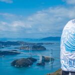
In 2026, Adventure Cycling is celebrating its Golden Jubilee with an awfully nice gift: the Golden Gravel Trail, a brand-new cross-country gravel route.
Clocking in at some 3,700 miles, around 70 percent of which is off-pavement, and stretching from the Mississippi River to the Pacific Ocean, the route is Adventure Cycling’s longest since the 4,296-mile Northern Tier debuted in 1984. (The only other route that’s longer, of course, is the TransAmerica Trail.)

“It’s a beautiful route,” says Adventure Cycling cartography program manager Amy Wally. “It’s very scenic. It doesn’t always take the most direct route, but it takes the best route. It’s meticulously researched, and so pretty much every road is there for a reason.”
However, Wally is also quick to note that this route is no “ride through the park.”
“It’s going to be challenging,” she says. “You’re going to have rough weather. There are some tough climbs and rugged parts. But overall, I think people are gonna just love it. It’s gonna be an adventure.”
Golden Origins
In early 2025, Adventure Cycling’s routes team began planning its year. With the nonprofit’s 50th Anniversary rapidly approaching, the team wanted to create multiple routes and eventually settled on three: two shorter loops and one “epic” trip. “We threw that word around a lot,” Wally says. While brainstorming, the team scoured spreadsheets of ideas, paged through member emails, but nothing felt epic enough.

Then, former routes director Jenn Hamelman remembered an Adventure Cyclist article she read years ago about Sarah Swallow. Along with her partner, Swallow was the first cyclist to ride the TransAmerica Trail (not to be confused with ACA’s route by the same name) cross-country, dual-sport motorcycle route. Maybe that could be a starting point?
As the team reviewed the route, it quickly became apparent it was a good starting point but would require rerouting it and rebuilding it almost from the ground up to make it cyclist friendly. After all, the nearly 6,000-mile TAT was built with engines in mind, meaning it often dipped onto highways, skipped bike paths, went extreme distances between services, and popped up and down steep, rugged 4X4 roads.
Still, the bones were there.
So, the team got to work — very, very fast. The reasons for such an expedited approach? To have the route ready for Adventure Cycling’s Golden Jubilee, route researchers would need to be on the ground within months. Fortunately, Wally says, they were able to do just that. By May, John Hormell was in Missouri and Oklahoma. Not long after, Nat Cobb deployed to Colorado and Utah, and Jeremy Nolan headed to Idaho and Oregon.
With field observations in hand, Wally reviewed the entire 3,700-mile track mile by mile in July. Then, for a nice bookend, Sarah Swallow headed out on the newly named Golden Gravel Trail in August to help vet the route she inspired by riding the western portion solo from the Pacific to Colorado.
The Bigger Picture
Looking at Golden Gravel Trail on a map as it winds, ducks, and bobs across the United States from Cape Girardeau, Missouri, to Port Orford, Oregon, you’ll note some (often literal) parallels with a similarly ambitious Adventure Cycling route. That route, of course, is the TransAm, which debuted 50 years ago.

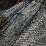
However, while there are some broad geographic similarities between the two rides, those largely stop once you zoom in and examine the Golden Gravel Trail more closely. For starters, although both traverse the same geographic regions, including the Great Plains, Colorado Rockies, and Pacific Coast Ranges, in roughly the same order, the Golden Gravel Trail mostly does so on unpaved roads, far from many of the amenities you’ll find along the TransAm. That remoteness means riders face a far different set of logistical and physical hurdles.
That’s why Wally notes that there’s actually another Adventure Cycling route that’s a much closer cousin to the Golden Gravel Trail: the Great Divide Mountain Bike Route.
“I’ve described this route to some people as if the Great Divide were just turned sideways,” she says. In fact, both feature a similar average elevation gain per mile, but that number doesn’t take into consideration how heavily skewed the climbing is in the western half of the Golden Gravel Trail, which leaves the plains behind in Colorado.
What Direction Should You Ride
The intended westbound direction sees riders begin just steps from the Mississippi River in Cape Girardeau, Missouri, so that they’ll start with gentle, rolling terrain. They’ll hit some climbs as they pass through the Ozarks into Oklahoma and the Great Plains beyond, but for the most part, they’ll have plenty of time to build up their legs over hundreds of largely forgiving miles, a grace period Wally intentionally baked into the route. (That said, you can tackle the route in reverse if that proves easier logistically, which is what Sarah Swallow did during her test ride. More on this below.)
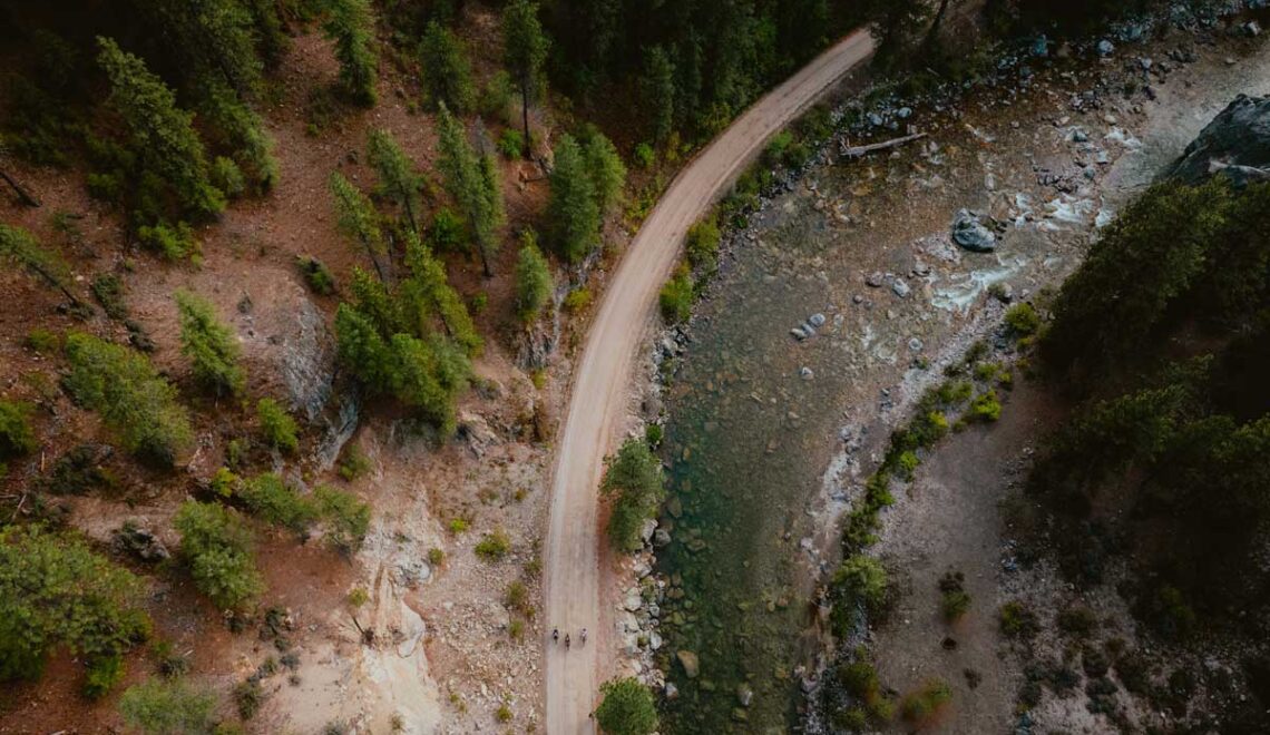
Eventually, riders will reach Pueblo, Colorado, after which they’ll tackle the route’s first true climbs — including ascending 12,000-foot Cumberland Pass — as they churn through the Rockies. From there, they’ll pass through Utah’s red rock desert, along the mountain hot springs of Idaho, and under the big skies of Oregon’s high desert. Finally, they’ll make their way through the temperate rain forests of the Cascades and wind down to the western terminus on the Pacific Coast.
If you read that and thought, “Jeez, that sounds like an awful lot of different climates,” you’re absolutely right. Diversity is a major part of what makes the Golden Gravel Trail so unique, but because each region poses its own set of challenges and requires its own clothing and gear to protect against the elements, it also means timing and preparation matter just as much as fitness.
Timing is Everything

While giving your legs an easier start and finishing your tour by dipping your tire in the Pacific are both reasons enough to ride east to west, there is one major obstacle — the weather.
First, you’ll have to wait to set out until Missouri’s winter weather and spring storms have subsided for the year. There are dozens of bridgeless, low-water crossings throughout the state, and during snow melt or after a storm, some can go from ankle-deep to completely impassable. Starting in late June or July, however, poses its own challenges. Missouri summers are notoriously hot and humid, but a sacrifice must be made to avoid hitting the Utah desert during the extreme heat of mid-summer and before snow closes the mountain passes further west. “And you don’t want to be in the Utah desert in July,” Wally says.
Eastbound riders get a slightly wider and more forgiving weather window. “Departing from Port Orford between mid-July and late August is more likely to place you in each regional biome at just the right time,” Wally says. “You get the best weather conditions the whole way across. You’ll probably have great weather on the West Coast, you’ll cross the mountains before the snow, and skip the extreme heat — for the most part — in the Utah desert. When you get to Missouri, it’ll be September or October, and the weather will probably be amazing. The humidity will likely be lower.”
Both directions will contend with wildfire and smoke in the western portions no matter the weather. Another option is to ride the route in sections. By choosing when, where, and how far you’ll ride, you can avoid stressing over those weather windows.
Know Before You Go
Of course, planning a 3,700-mile trip is a far more extensive endeavor than we can cover here. So, anyone interested in the hyper-specific minutiae should download Adventure Cycling’s free route on Ride with GPS, available in early March 2026. Still, there are some bigger-picture notes:
Resupplying
When it comes to supply stops, not all legs of the route are equal. Starting in Missouri, small resupply towns appear every 20 to 50 miles, with a few exceptions. By the time you reach Oregon, however, those distances can stretch as long as 70 to 160 miles. So, it’s important to be able to carry at least two- to three-days of food and at least one- to one-and-a-half days worth of water during arid stretches in Oklahoma, Colorado, Utah, Idaho, and Oregon.
For those who aren’t content to subsist on gas station candy bars, sodas, and hotdogs of uncertain vintage, Wally suggests stopping in the following communities, which can be great options for resupply, rest days, and proper meals:
- Cape Girardeau, Missouri
- Pittsburg, Kansas
- Liberal, Kansas
- Pueblo, Colorado
- Salida, Colorado
- Crested Butte, Colorado
- Moab, Utah
- Park City, Utah
- Lava Hot Springs, Idaho
- Blackfoot, Idaho
- Sun Valley, Idaho
- Mitchell, Oregon
- Oakridge, Oregon
- Glide, Oregon
Camping
Although dispersed camping is all but ubiquitous from the Rockies west, that’s often not the case east of Colorado. Many of the tent sites in Oklahoma, for example, are in private campgrounds. “Oklahoma is just not really a camping hotspot,” Wally notes. “You will probably have to stay in a few motels because there’s not really any other option.” In Missouri, there are a few more options for sleeping under the stars, but the route doesn’t pass much public land, so dispersed camping opportunities are still limited. But don’t worry, accommodations are one of the services clearly marked on every Adventure Cycling route.
Wildfires
“Smoke sucks, but it’s just kind of a reality that we deal with here in the West. And it’s getting worse and worse,” Wally says. “Some years are great, some years are terrible. You just have to see how it goes. It’s just like a lottery every year.” While some riders with strong lungs may decide to just suffer through it (she doesn’t recommend it), riders with asthma will need to be particularly careful about which way the winds are blowing.
Bike Recommendations
A gravel bike or hardtail mountain bike with 2.2- to 2.6-inch tires would be ideal. Suspension is not necessary for much of the route, but it would provide a smoother ride through some of the washboarded and rougher sections. Sarah Swallow, who recently previewed the route from Oregon to western Colorado, rode an Otso Cycles Fenrir Ti Flat Bar with a Rockshox Sid SL Ultimate 3P shock and 2.4-inch tires.
Be Patient
Compared to other Adventure Cycling routes, the Golden Gravel Trail is basically the equivalent of a toddler: It’s still learning how to navigate the world, still making some mistakes, still in need of some corrections as it grows. So, while Wally is happy with the route as it currently stands, in the coming months, she also hopes to hear from riders about their experiences. That feedback will allow Adventure Cycling to refine the route and make it even better than it is today. Submit your suggestions on our Route Feedback Form.

What’s just as important, however, is that early adopters realize that they are ambassadors for Adventure Cycling. The Golden Gravel Trail passes through many communities accustomed to bike travelers, but there will be other communities for whom cyclists are a novelty.
“It won’t be perfect, and it won’t always be easy,” Wally says. “But that’s what makes it epic.”
The post Practical Advice for Riding Adventure Cycling’s Golden Gravel Trail appeared first on Adventure Cycling Association.